
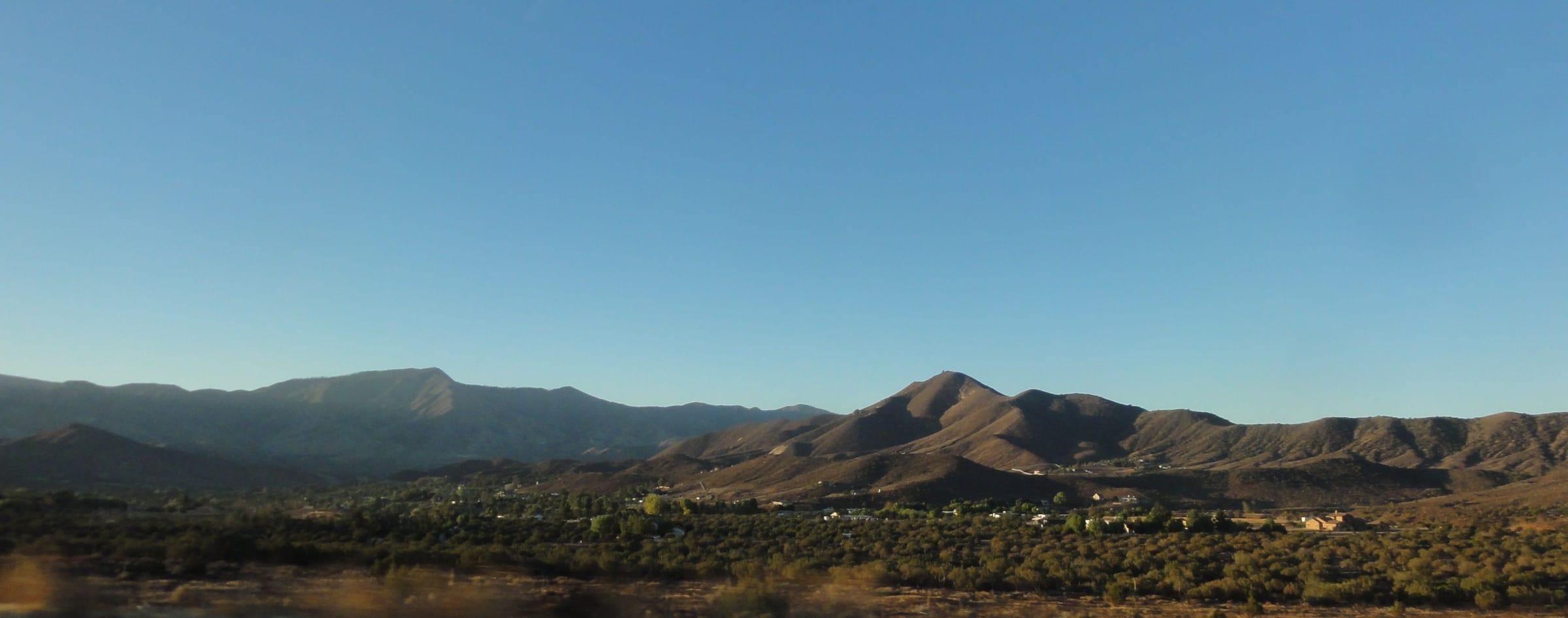
Acton is an unincorporated community in northern Los Angeles County, about 12 miles south of Palmdale along the Antelope Valley Freeway (State Route 14) and roughly 50 miles by road from downtown Los Angeles. Living there means rural, spread-out land: about 7,400 residents (2020 Census) share roughly 39 square miles next to the Angeles National Forest, and county rules are written to protect Acton's rural, equestrian and agricultural character.
The Acton market / right now
- Homes for sale
- 52
- Median list price
- $899K
- Median sale price, 90 days
- $963K
- Median days on market
- 17
From MLS data as of Nov 16, 2026; 20 closed sales in the last 90 days. Numbers update every 15 minutes.
What would a home here cost each month? Try the mortgage calculator
Living in Acton
Acton sits in the hills at the southwestern edge of the Antelope Valley, south of Palmdale along State Route 14 and next to the Angeles National Forest. LA County's Antelope Valley Area Plan notes that natural hillsides and ridgelines separate Acton from Palmdale and the rest of the valley, and that separation shapes daily life: open land between neighbors, few streetlights and views of the surrounding ridges.
Acton is not a city. It is an unincorporated area, so Los Angeles County handles planning, zoning and most local services. The Acton Town Council, a local civic organization, holds public meetings on the first Monday of each month at the Acton Agua Dulce Library.
Acton developed in the 1800s as a center of gold and copper mining, grew after the railroad arrived, and later turned to ranching. That Western history is written into today's rules: the Acton Community Standards District calls for new commercial buildings designed in a Western frontier village style, and the county's Area Plan calls for Old West design in the small town center along Crown Valley Road.
Land and housing
Most of Acton is planned as a rural town area. The Antelope Valley Area Plan assigns much of it to rural land categories that allow one home per 1, 2 or 5 gross acres, with a few small pockets of denser residential land near the town center. The outer rural preserve areas are designated for one home per 10 or 20 gross acres, and the plan states that these designations reflect existing densities rather than invite further subdivision.
U.S. Census Bureau survey estimates show about nine in ten Acton homes are detached single-family houses. The county's plan describes parts of the community as developed with agricultural uses and single-family homes on large lots, and it supports agriculture, equestrian and animal-keeping uses where a lot meets Zoning Code requirements. The Acton Community Standards District also sets minimum lot sizes of one to two gross acres for new residential lots in its rural land categories.
Rural land comes with its own checklist. The Community Standards District is written to minimize sewers, streetlights, concrete sidewalks and concrete flood-control channels, and the Area Plan notes that some parts of Acton are not served by existing infrastructure and some fall within Very High Fire Hazard Severity Zones. Before you buy, confirm a parcel's zoning, water source, wastewater system, road access and fire-zone status.
Things to do
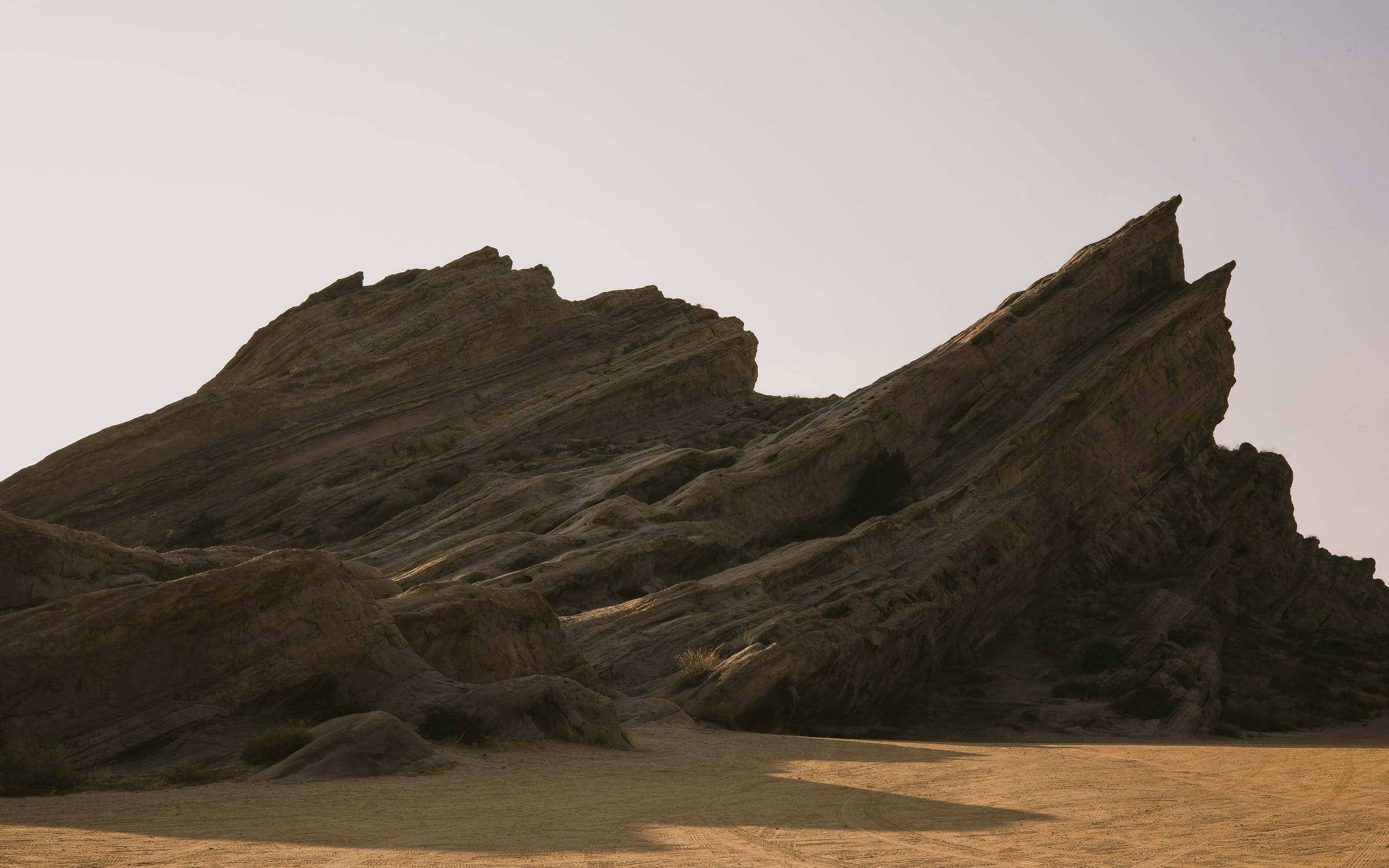
Trail access is built into Acton's planning. The Community Standards District aims to keep public riding and hiking trails accessible, and the surrounding Angeles National Forest is managed by its Santa Clara/Mojave Rivers Ranger District; the Forest Service's Acton Work Center is on Crown Valley Road. About 10 miles west, Vasquez Rocks Natural Area in neighboring Agua Dulce adds 945 acres of rock formations and trails, including a section of the Pacific Crest Trail.
Closer to home, Acton Park on Syracuse Avenue is a 12.5-acre LA County park with a ball field, playground, basketball court and picnic areas, plus summer movie nights and concerts. The Acton Agua Dulce Library on Crown Valley Road hosts the town council's monthly meetings.
The Shambala Preserve, a big-cat sanctuary founded by actress Tippi Hedren and run by The Roar Foundation, opens for guided safaris one weekend a month by advance reservation, for visitors 18 and older. Soledad Canyon Road, which follows the upper Santa Clara River west toward Santa Clarita, is a slower alternative to the freeway.
Getting around
State Route 14 runs through Acton and is the main route both north to Palmdale and south to Santa Clarita, Interstate 5 and Los Angeles. Sierra Highway and Soledad Canyon Road handle local trips. The drive times listed below are typical off-peak estimates; traffic varies, especially on SR-14 during weekday rush hours.
Acton has its own commuter rail stop. Metrolink's Vincent Grade/Acton station at 730 W. Sierra Highway is served by the Antelope Valley Line and offers free parking, with 414 spaces and no overnight parking.
Commutes tend to be long: Census Bureau survey estimates put the mean travel time to work for Acton residents at 47.2 minutes.
Places people love
Vasquez Rocks Natural Area (nearby)
About 10 miles west in neighboring Agua Dulce, this 945-acre LA County park is known for its tilted rock formations and a long history as a filming location. Its trails include a section of the Pacific Crest Trail, and the site is the ancestral Tataviam village of Mapipinga.
Angeles National Forest
National forest land borders Acton, and the Forest Service's Santa Clara/Mojave Rivers Ranger District manages the surrounding trails and back roads. The Acton Work Center sits on Crown Valley Road.
Acton Park
A 12.5-acre LA County park on Syracuse Avenue, dedicated in 2005, with a ball field, playground, basketball court and picnic areas. It hosts seasonal programs such as summer movie nights and concerts.
Shambala Preserve
A sanctuary for big cats founded by actress Tippi Hedren and operated by The Roar Foundation. It opens for guided safaris one weekend a month by advance reservation, and visitors must be 18 or older.
Soledad Canyon and the Santa Clara River
Soledad Canyon Road follows the upper Santa Clara River west from Acton toward Santa Clarita. It is a slower, winding alternative to SR-14 through a rocky canyon.
Crown Valley Road town center
Acton's small commercial center runs along Crown Valley Road between Gillespie Avenue and Soledad Canyon Road, where county rules call for Old West design and two-story buildings. The Acton Agua Dulce Library is also on Crown Valley Road.
School districts
Acton-Agua Dulce Unified School District
K–12 district headquartered on Crown Valley Road in Acton; serves Acton and Agua Dulce. Confirm school assignment by address with the district.
Attendance boundaries vary by address; confirm with the district before you buy.
Drive times
| Destination | Distance | Typical time |
|---|---|---|
| Downtown Los Angeles | About 50 miles | 55–70 min (typical off-peak; traffic varies) |
| Santa Clarita | About 25 miles | 25–35 min (typical off-peak; traffic varies) |
| Palmdale | About 12 miles | 15–20 min (typical off-peak; traffic varies) |
Typical off-peak times; traffic varies.